
How GEO.works fits with Street Manager, one.network, Confirm, and your GIS
GEO.works doesn't replace the systems your team already relies on.
It's the operational layer that sits between them, covering permit review, TTRO management, lane rental compliance, and Section 74 reinstatement.
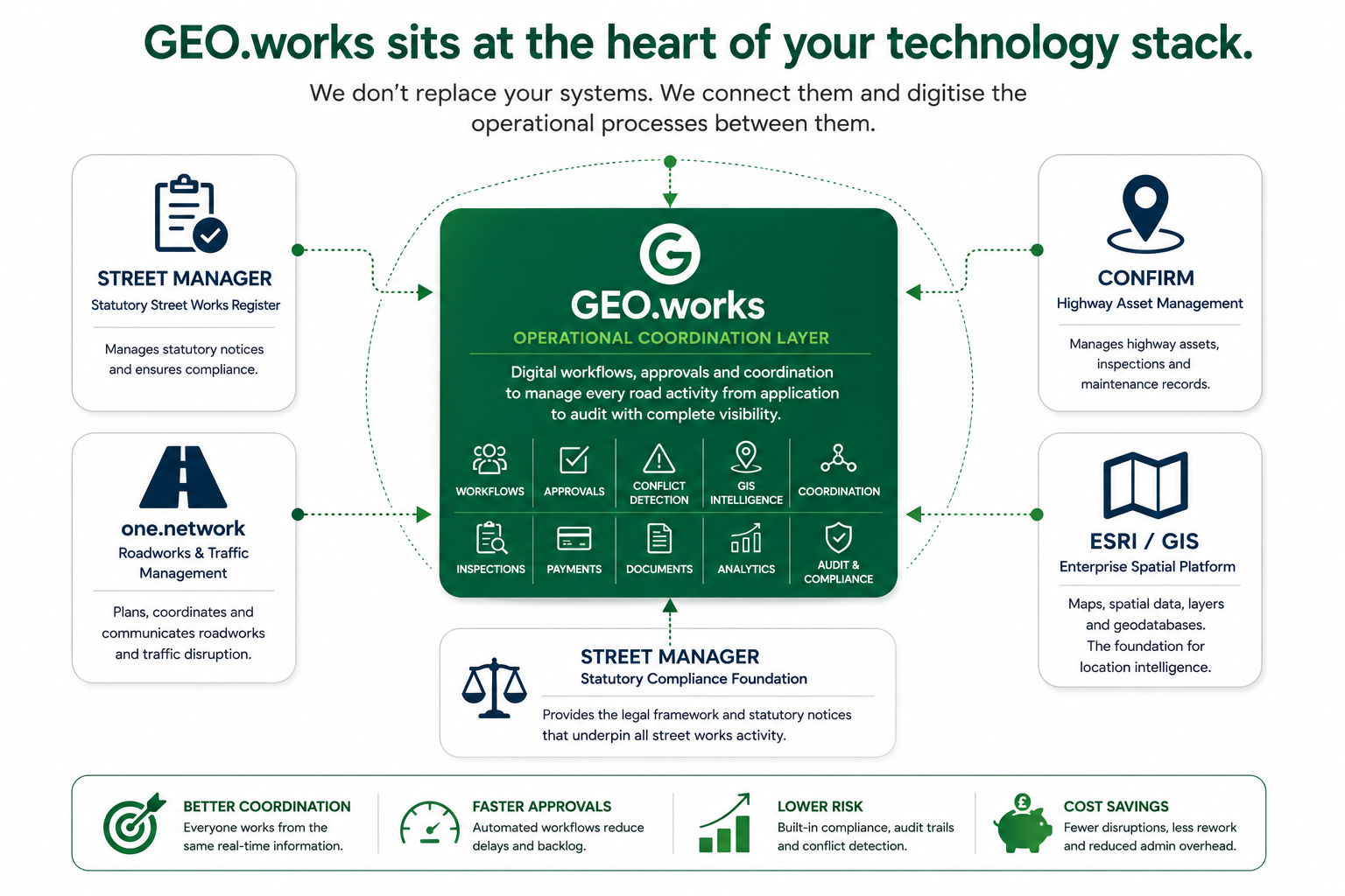
What the diagram is showing
Four systems your team already relies on, and the operational layer that connects them and does the work none of them were built to do.
Street Manager
Manages statutory notices and ensures compliance. Provides the legal framework that underpins all street works activity. GEO.works integrates with it rather than replacing it.
one.network
Plans, coordinates, and communicates roadworks and traffic disruption. Solves public and network-level visibility, a different problem to permit workflow.
Confirm
Manages highway assets, inspections, and maintenance records. A direct commercial alternative in parts of the workflow, and a genuine strength on audit and compliance.
ESRI / GIS
Maps, spatial data, layers, and geodatabases. The location intelligence foundation that GEO.works' business rules and conflict detection are built on top of.
GEO.works
Digital workflows, approvals, and coordination to manage every road activity from application to audit, with complete visibility. This is the layer that sits between the four systems above and does the day-to-day work none of them fully cover: workflows, approvals, conflict detection, GIS intelligence, coordination, inspections, payments, documents, analytics, and audit and compliance.
What sitting in the middle actually delivers
- Better coordination. Everyone works from the same real-time information.
- Faster approvals. Automated workflows reduce delays and backlog.
- Lower risk. Built-in compliance, audit trails, and conflict detection.
- Cost savings. Fewer disruptions, less rework, and reduced admin overhead.