
The Operational Layer for UK Streetworks
GEO.works connects the systems, teams and processes involved in streetworks into one live operational platform.
From permits and approvals through coordination, inspections, utilities and audit reporting, every stakeholder works from the same operational picture.
More Than Permit Management
GEO.works acts as the operational layer between your systems, teams and processes, turning fragmented streetworks activity into one connected operational picture.
Connect
Connect Existing Systems
Not another silo.
GEO.works works alongside Street Manager, one.network, EToN, ESRI, Confirm and your existing systems, bringing operational information together in one live platform.
Coordinate
Coordinate Every Stakeholder
One operational picture.
Councils, utilities, contractors, inspectors and partner agencies all work from the same live operational view, improving collaboration and reducing conflict.
Configure
Configure Around Your Processes
Your workflows. Not ours.
Configure permit types, approvals, routing, fees, forms and business rules without custom development or ongoing vendor dependency.
Control
Deliver Operational Confidence
Every decision. Fully traceable.
Every permit, inspection, approval and operational change is time-stamped, auditable and available through live dashboards and performance reporting.
One Live Operational Picture
GEO.works brings mapping, workflows, utility intelligence, approvals and reporting together, giving streetworks teams a clear view of activity across the network.
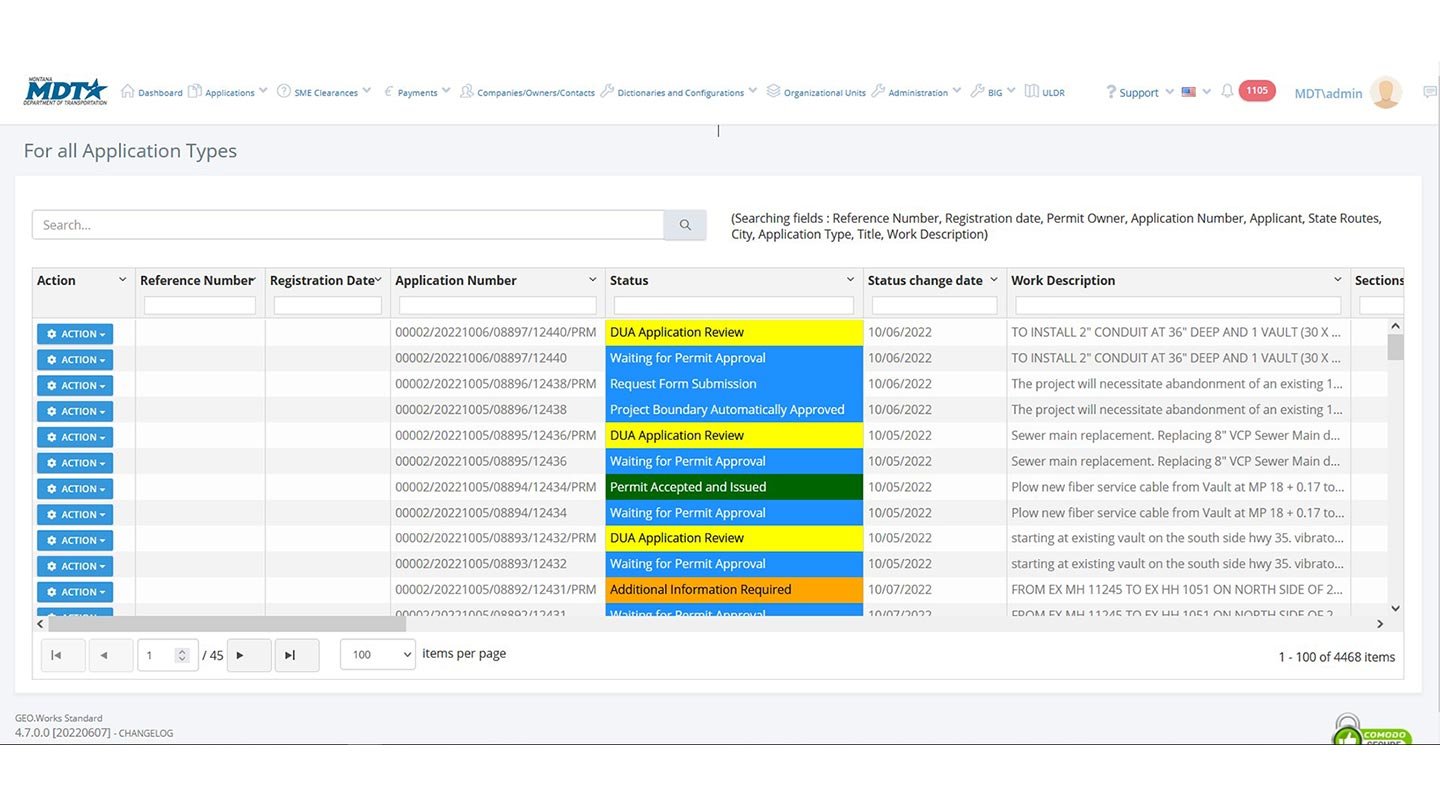
Operational Permitting
Digitise, validate and coordinate applications from submission through approval.
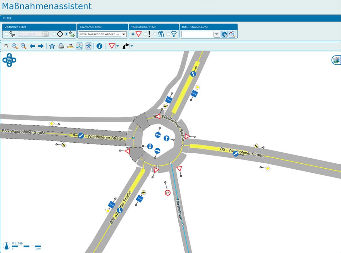
Traffic Management
Coordinate restrictions, traffic management and operational activity from one live map.
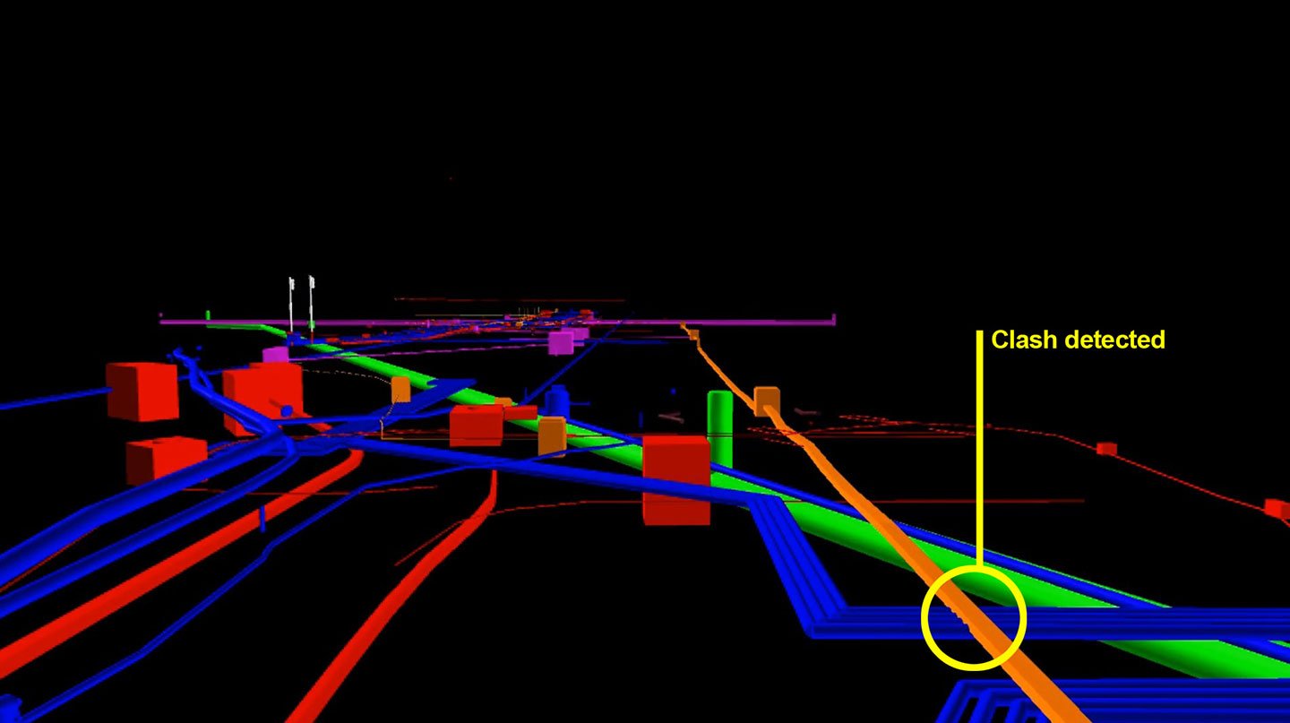
Utility Conflict Detection
Identify clashes before work begins, reducing delays, rework and disruption.
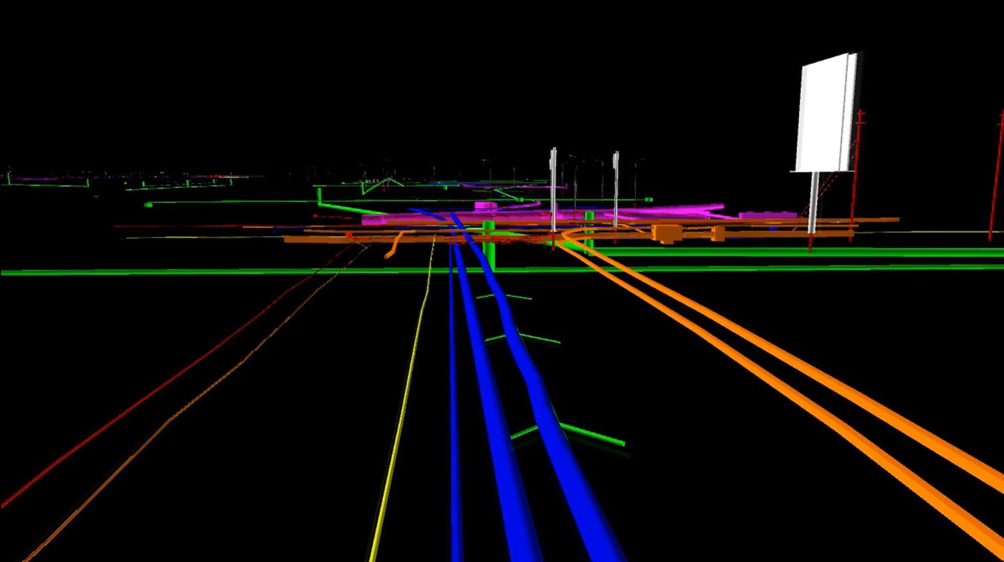
3D Utility Intelligence
Capture and visualise underground assets and as-built information to improve long-term network knowledge.
How the Operational Layer Works
GEO.works connects fragmented systems and workflows, turning them into one coordinated streetworks operation.
Connect Systems
Bring together statutory systems, GIS, asset platforms, finance, documents and existing operational tools.
Unify Operational Data
Combine permits, inspections, utility information, occupations, approvals and field activity.
Coordinate People and Processes
Connect authorities, utilities, contractors, inspectors and partner agencies around shared workflows.
Deliver Control and Insight
Use live dashboards, conflict detection, audit trails and reporting to improve operational decisions.
Built for the Full Streetworks Operation
One configurable platform supports the core operational processes authorities manage every day.
Permits and Approvals
Digitise applications, validation, routing, reviews, approvals and applicant communication from submission to completion.
Explore permits →Utility Coordination and As-Builts
Coordinate utility activity, capture accurate field data and maintain trusted as-built records within the same process.
Explore utility coordination →Inspections and Compliance
Schedule inspections, record field evidence, track defects and maintain a complete operational audit history.
Explore inspections →Traffic Management and D-TROs
Manage restrictions, traffic plans, approvals and operational communication through structured, map-based workflows.
Explore traffic management →Lane Rental and Fees
Automate charging rules, operational reviews, payment handling, evidence and performance reporting.
Explore lane rental →Occupations, Events and Access
Manage highway occupations, public events, access applications and related approvals through one configurable platform.
Explore additional workflows →Shared Operational Platform
- Shared geospatial data
- Shared users and permissions
- Shared audit history
- Shared reporting
- Shared integrations
Configurable Workflows
- Streetworks permits
- Inspections
- D-TROs and traffic plans
- Utility as-builts
- Lane rental
- Events and occupations
Works With the Systems You Already Use
GEO.works complements existing investments rather than forcing authorities into another costly replacement programme.
Proven Operational Outcomes
Better coordination, faster decisions and a clearer operational picture across the network.
55%
Faster permit approvals
66%
Lower administrative workload
95%
Fewer traffic conflicts
1.2M+
Permits managed annually
Your Authority Already Has Systems.
Now Give Them an Operational Layer.
See how GEO.works can connect your existing systems, workflows and teams into one coordinated streetworks operation.
Book a Demonstration