Digital Transformation for Highways & Roads Authorities
Empowering highways authorities, route operators, and traffic management teams to digitise TTROs, closures, lane rental, resurfacing works, utilities coordination, inspections, and network-wide operations, all through one modern, GIS-powered platform.

| Workflow | Key Outcomes |
|---|---|
| TTROs & Road Closure Permitting | Faster approvals, conflict prevention, transparent coordination with TM teams and safety standards |
| Lane Rental, Resurfacing & Major Works Management | Streamlined submissions, digital TM plans, clearer scheduling across contractors and operators |
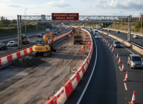
| Utility Works & Asset Maintenance (Highways & Road Corridors) | Prevent overlaps, coordinated notifications, reduced operational disruption across the network |
| Traffic Management Plans (Diversions, Lane Drops, Contraflows) | Automated approvals, digital records, improved safety and compliance alignment |
| Compliance & Audit Readiness for Highways Operations | Instant audit reports, full traceability, evidence packs for statutory and internal compliance teams |
One Platform, Shared Visibility
Proven Efficiency for Highway Operations
GEO.works UK connects highways maintenance, resurfacing, traffic management, utilities, TTRO planning, and contractor teams through one shared GIS-based platform.
Everyone works from the same live network data — eliminating duplication, preventing clashes, reducing delays, and improving operational control across major routes and road corridors.
Example Use Cases:
-
Network managers see all planned and active works — resurfacing, lane closures, utility digs, TM deployments — on one live map.
-
TTRO and TM teams coordinate closures and diversions with automated conflict checks and instant visibility of overlaps.
-
Utilities, contractors, and route operators update works in real time, preventing last-minute clashes, overruns, and unnecessary congestion.
Highway networks across Europe and the UK use GEO.works to manage TTROs, lane closures, utility works, resurfacing, and maintenance through one unified platform. Instead of juggling spreadsheets, email chains, and separate traffic management tools, teams coordinate every activity from a shared live network view.
With standardised workflows for approvals, traffic management, and safety checks, operators cut turnaround times, reduce clashes, and keep more lanes open for longer. Live GIS insight gives everyone — network control, TM providers, utilities, and contractors — the same picture of what is happening on the road at any moment.
UK highway and strategic route operators can now adopt the same approach — configured for local operating policies, lane rental schemes, and safety governance, with full audit readiness across routes, corridors, and key junctions.
Ready to Modernise Your Highways & Roads Operations?
Book a live demo with our UK team and see how GEO.works helps highways authorities digitise TTROs, streamline traffic management, reduce administrative workload, and improve coordination across every route and region.